Category:Flood protection in Wales
Jump to navigation
Jump to search
Subcategories
This category has only the following subcategory.
C
Media in category "Flood protection in Wales"
The following 28 files are in this category, out of 28 total.
-
Adeiladu Cynllun Llifogydd Llanelwy - Building the St Asaph Flood Scheme.webm 2 min 34 s, 640 × 360; 13.16 MB
-
 Afon Crafnant - geograph.org.uk - 993932.jpg 640 × 480; 81 KB
-
 Chepstow Flood Prevention - geograph.org.uk - 204969.jpg 640 × 480; 415 KB
-
Cynllun Llifogydd Pontarddulais Flood Scheme.webm 2 min 24 s, 640 × 360; 13.71 MB
-
 Drws yn Aberteifi.jpg 3,024 × 3,024; 3.62 MB
-
 Flood barrier, Llanpumsaint (geograph 6141837).jpg 2,000 × 1,500; 1.08 MB
-
 Flood defences for the former railway - geograph.org.uk - 413179.jpg 640 × 480; 154 KB
-
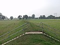
 Flood prevention scheme (geograph 6977384).jpg 4,032 × 3,024; 2.92 MB
-
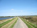
 Flood protection bank - geograph.org.uk - 593665.jpg 640 × 480; 79 KB
-
-
St Asaph Flood Scheme - Cynllun Llifogydd Llanelwy.webm 3 min 32 s, 640 × 360; 17.83 MB
-
The River Ely Tree Catcher, Cardiff, Wales (English version).webm 6 min 6 s, 1,280 × 720; 44.12 MB
-
 Balderton Brook outfall - geograph.org.uk - 1407632.jpg 640 × 457; 390 KB
-

-

-
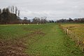
 Embankment - geograph.org.uk - 274860.jpg 640 × 480; 123 KB
-
 Flood bank - geograph.org.uk - 662075.jpg 640 × 480; 82 KB
-
 Flood control gates - geograph.org.uk - 579485.jpg 640 × 480; 73 KB
-
-

-
 Flood plain - geograph.org.uk - 146938.jpg 640 × 155; 107 KB
-
 Flood relief - geograph.org.uk - 290820.jpg 640 × 469; 80 KB
-

-
-
 River bank at Glasbury - geograph.org.uk - 540418.jpg 640 × 480; 157 KB
-
 Stream diversion - geograph.org.uk - 121001.jpg 640 × 393; 92 KB
-
 The rebuilt Tirymynach Embankment - geograph.org.uk - 581010.jpg 640 × 480; 67 KB
-
 Tidal wall in Morfa Harlech - geograph.org.uk - 457111.jpg 640 × 480; 89 KB


.jpg)

.jpg)


